|
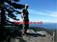
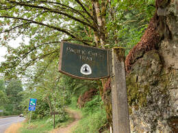
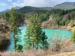
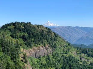
A friend of mine in the volkswalking community wants to section hike the PCT Trail in WA and asked if I would want to do this too. I am giving it some serious consideration. On Sunday morning (July 24th) we met at the parking lot by the Bridge of the gods off of SR14. We dropped off a car where the PCT crossed CG-2000 Rd near Rock Creek and then parked the other car where we started in the parking lot. It was 7:30am when we began walking. I was prepared. I made sure to eat a hearty breakfast. A bowl of oatmeal seemed like it would sustain me for a few hours. I carried 12oz of an electrolyte Nuun drink plus 100oz of water in a CamelBak. It was my first time using one and I am convinced it kept me hydrated as I sipped and walked. I carried medical supplies, an emergency blanket, flashlight, food, mapping apps etc... I let a friend know where I was going and sent him a photo of myself with what I was wearing on the hike. I knew this was not going to be an easy hike and I have heard of too many people who go missing in the Columbia Gorge each year. I had some personal concerns because I hadn't walked a long distance since Covid in 2019 nor had I carried a heavy daypack for many years. The walk to Gillette Lake was easy. (This is a photo of Gillette Lake from a previous trip) I had heard of Table Mountain and I knew it was a steep hike but I wasn't thinking of the elevation gain that we had ahead of us. By the end of the hike we had gained 4657 feet. We were climbing for most of the 19 mile hike. We spent alot of time hiking around Table Mountain and the slopes. We climbed switchbacks and rock slopes. 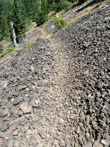 We crossed about 15 of these slopes with the rocks. And as the day dragged on the temperature climbed. I only know it was above the 90's. We reached a point where we discovered that there was a 10 mile section without a water source. In my mind I had that 'aha' moment. I really understood how easily hikers go on a hike in the Gorge and seriously underestimate the trail length, elevation and weather. We were at the halfway point and just in the beginning of the waterless stretch and the consequences of our decision could be the difference between a successful trip or being rescued. We pushed on and took our time. We met section hikers and thru-hikers which was fun. One woman said she had hiked 33 miles the previous day and was doing 19 the day we met her. I think the thru-hikers kept us motivated. My friend had his dog and had to share his water with his dog. Not having water for 10 miles became more critical as the day wore on. The PCT is as gorgeous as it is brutal. The views were stunning. At times we could look over to views of Bonneville Dam and then further along we had views of Mt Adams, Mt St Helens and even Mt Rainier. Mt Hood too. We both relied on STRAVA to mark our distance so it was disappointing when around 5:30pm I had reached the 18.5 mile mark and according to the maps we had another 3 miles to walk. PCT has it as an 18 mile stretch or 19 according to what books one reads. STRAVA had 21.47 miles when we finished our hike.
What I learned from that is not to assume STRAVA is correct in reporting mileage. It was an amazing hike. We finished in 9hrs and 34 minutes. I was tired since my day had begun around 4:30am but the next day I felt good except for a blister. I wore Altra Torins and I think my feet were beat up a bit on the rocky slopes. I have Altra hiking shoes and I think my next hike I will wear those instead. I am reassured that section hiking the PCT in WA is doable.
1 Comment
|
ScoutI am an avid walker and hiker. My favorite is a long hike. I also enjoy taking off and going on a meandering walk for a few hours. I've hiked rim to rim in the Grand Canyon and I did 3 Burning Boot Walks on Vancouver Island. Archives
August 2023
Categories |
- About
- Home
- AGING & HIKE/WALKING
- Blog
- Books
- Bridges
- Calendars & Events
- Competitive Walking
- Contact Form
- Flaneur
- Gear
- Hiking with Kids
- Indoor Walking
- Labyrinth
- Long distance hiking
- Nature
- Nordic Walking
- Orienteering
- Pilgrimage
- Rucking
- Seek and find while walking
- Stairs
- State Info
- Training & Health
- Volkswalking
- Walkability
- Walk - Hike Resources
- Walking history
- Walk, Roll, Stroll
- Walking info history
 RSS Feed
